Hiking Trails in Northwestern Ontario

Sunset Country in Ontario is a Great Place to Hike!
Gerry Cariou
By Gerry Cariou

Gerry Cariou is the Executive Director of Ontario's Sunset Country.

Last Updated: February 28, 2023

GO HIKING IN ONTARIO

With 100,000 square kilometers of Boreal Forest and 70,000 freshwater lakes, Northwestern Ontario has many great places to hike. One of the good things about hiking in these parts is the authentic experience we offer - largely wilderness trail systems that provide a real appreciation of the forest around you yet are easy enough to traverse for just about any level of hiker. For those whose passion is serious hiking, well, there are some wilderness treks within some of the more remote parks that will test your endurance and skills. If your traveling through one of our urban communities then the opportunity to hike is always there and in some cases, there are multiple trails available for you to choose from. This article is written as a guide to where you can go hiking - Spring, Summer, Fall, and Winter - in Ontario's Sunset Country.

Waterfalls can be seen along some of our trails - this is Raleigh Falls in Ignace

Number and Locations of Trails

Sunset Country covers a vast area that stretches from the Manitoba border east almost to the City of Thunder Bay and from the Minnesota-Ontario border north to Hudson Bay.  The vast majority of this huge area is Crown Land and inaccessible except by canoe or aircraft for most of the year. The areas where hiking trails are is generally near one of our smaller communities and in some cases, the community itself has an urban trail system network. Kenora is a good example of this. Here you can access trails that provide that authentic Boreal wilderness experience but which are right next to or in fact, located within the town boundaries. There are rural trail systems as well, mostly in the Provincial Parks across the region. All of these options will be highlighted below. 

If you're lucky, some wildlife may appear on the trail ahead of you!

Hiking Trails in Northwest Ontario by Community

Atikokan

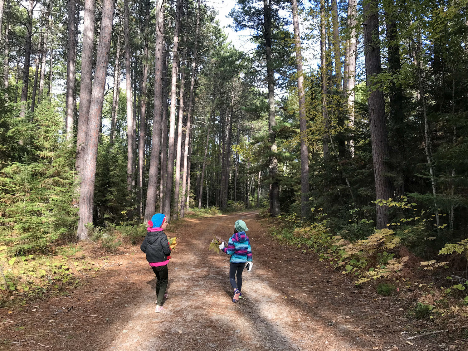
From a multi-use trail perspective, Atikokokan sure has a lot to offer, not only can you hike, but there are groomed and maintained trail systems for mountain bikers, x-country skiers, snowshoe, horseback trails, ATV, and snowmobile trails. The recommended "go-to" site for hikers is the trail system at Dawson Trail Campground - located in Quetico Park. Pines, Whiskey Jack, and Beaver Meadows are other trails you can hike. Here is some more detailed information on the excellent nature trails in the Atikokan area.  

The Visit Atikokan website is another great resource for any trail user. 

Dryden

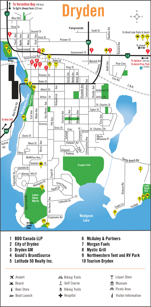
Dryden has a lot to offer anyone who loves hiking. There are a number of trails in or near the City and you can tackle a couple (or more) in a day if you feel energetic. The City's website has some really good information on the places you can hike near Dryden. If your willing to take a short drive, hiking trails like the Laura Howe Marsh and trails near Aaron and Blue Lake Provincial Parks are fantastic! Another Gem is the Ghost Lake Trail system along with the Mavis Lake Trail.

Ear Falls

Located about halfway up the Red Lake Road (Highway 105), Ear Falls offers hikers a number of opportunities to traverse the Boreal forest on trails in the area. You can access the local Ear Falls hiking trails right off the English River Rd and there is a parking area for your vehicle. The total trail length is about 15 kilometers with moderate to difficult loops. A bonus is that these are multi-use trails and offer excellent cross-country skiing during the winter months. 

Fort Frances

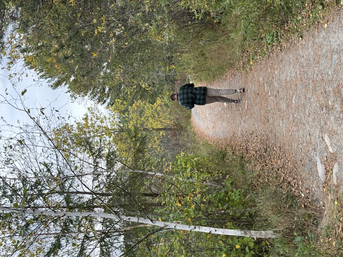
If you like hiking you'll find a lot of trails you can access around Fort Frances. If you want to stay in Town then the 8th Street Trails on the north end of Fort Frances are the place to go. You can also cross-country ski on this system in the winter months. Just outside of Fort Frances in the Township of Alberton is the Cranberry Peatlands Interpretive Trail, an amazing hike and really worth the drive. 

Ignace

Located between Dryden and Thunder Bay, Ignace is a very interesting area to hike because of the unique natural features in this part of Sunset Country. For those looking for a moderate to difficult hike, the Agimak Trail is ideal with the beauty of the Boreal Forest in full splendor along the route. An easier trek can be found on the Lily Pad Lake trail system, a series of trails with short and longer loops all easy to hike for the novice hiker. Nearby Sandbar Provincial Park also has a system of trails ranging from easy to moderate in difficulty. Learn more about the nature trails in Ignace here.

Kakabeka Falls

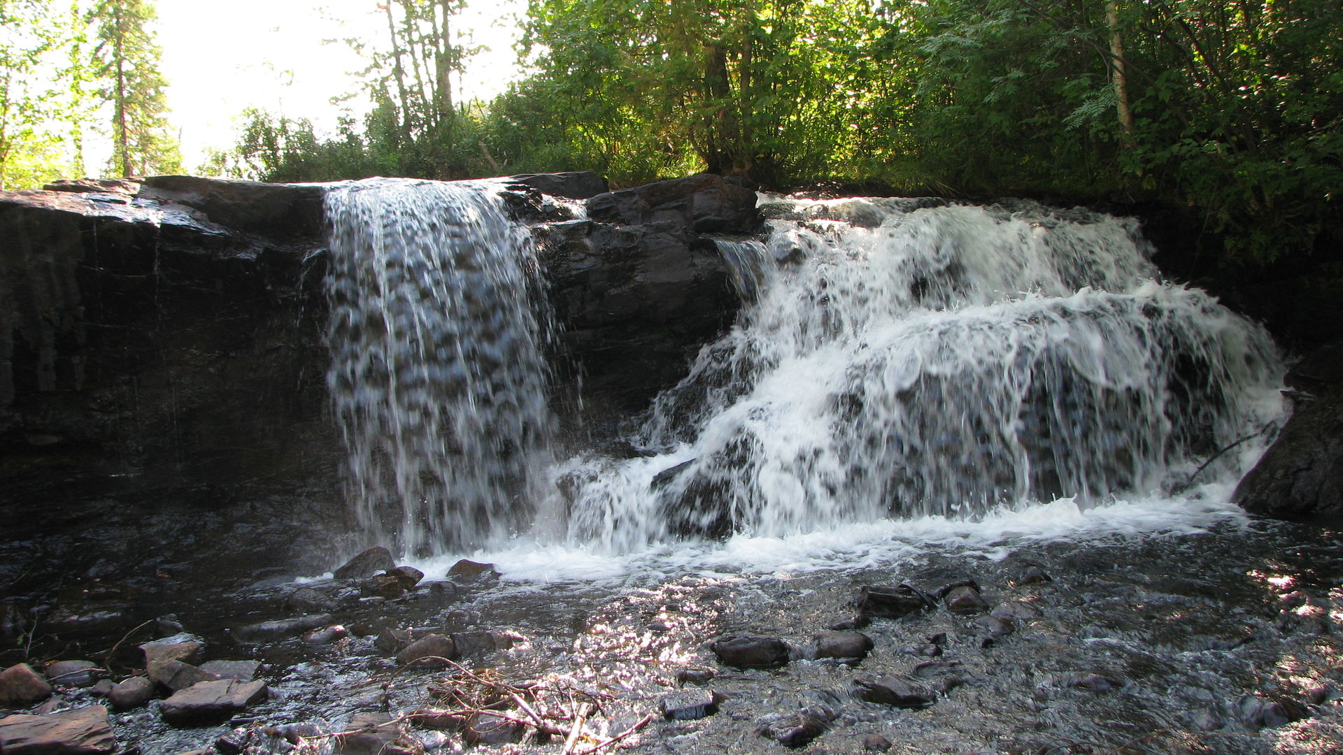
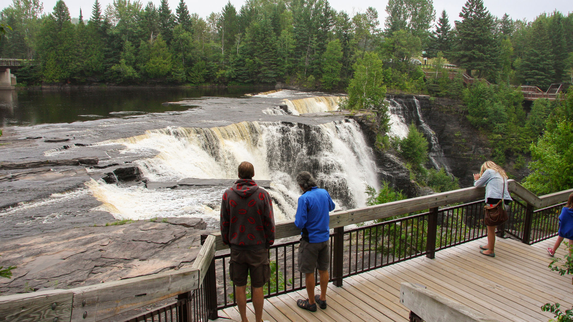
Located just a short drive west of Thunder Bay, Kakabeka Falls is a fantastic hiking destination specifically, on the trails in Kakabeka Falls Provincial Park. In total, there are 5 trails within the park ranging in difficulty from easy to difficult. The Boardwalk Trail is also wheelchair-accessible. Take in a great view of the spectacular waterfall known as the "Niagara of the North".

Ghost Lake Hiking Trail Near Dryden - Photo: Lori Romas

Kenora

The City of Kenora is a hiker's paradise with an extensive network of urban trails across the community. Even though many of the trails begin right in town, they still offer the magnificent Boreal forest experiences Northwestern Ontario is famous for. Tourism Kenora even has a mobile urban Trails App that you can download from the Google Play store. You can also download a digital copy of the Kenora Urban Trails Guide. There are also excellent hiking opportunities at nearby Rushing River Provincial Park.

Minaki

Located on the mighty Winnipeg River System Minaki, Ontario has an extensive network of multi-use trails that are great for hiking. There is the "Club Minaki" trail system offering hikers and skiers access to the forest landscapes and there is a lot of nature to see. There is a trail fee charged that goes towards trails maintenance and the trails are maintained by volunteers. 

Rainy River

The River Trail located in town and along the waterfront provides a good, albeit mostly urban hiking experience with great views of the Rainy River! Nearby at Kay-Nah-Chi-Wah-Nung Historical Centre, where you can view ancient indigenous burial mounds, there is also an opportunity to hike as you make your way to the mounds on the extensive trail system. Designated a National Historic Site in 1969, the Historical Centre is a must-see if you are traveling through the area. 

Red Lake

Red Lake is located north of Ear Falls at the terminus of Highway 105. Hikers can expect a fabulous experience here with an extensive system of multi-use trails that are excellent for hiking. You can traverse to McKenzie Island - first on a ferry - then walk the fantastic system of nature trails that are there. In addition, Pakwash Provincial Park south of the Municipality also offers a good system of hiking trails. Learn more about the things to do in Red Lake here.

Sioux Lookout

The Umfreville Trail is an 8-kilometer long paved walkway that begins at the Travel Information Centre and winds its way through forests of balsam, birch, pine, and poplar. The trail is designated as multi-use but is excellent for hiking. You can also hike famous Sioux Mountain and enjoy the lookout once you reach the top! Nearby Ojibway Provincial Park has an extensive 11-kilometer system of hiking trails ranging from easy to difficult with one rated at 2.5 hours long to complete! The Cedar Bay Recreation Complex also offers an extensive network of nature trails. 

Sioux Narrows-Nestor Falls

These two tourist communities, located on the eastern shore of Lake of the Woods offer a variety of hiking trails that can keep anyone busy for several days. The Lake of the Woods Trail Guide provides good information on where you can hike. There are three trails located in Sioux Narrows Provincial Park and the Lookout Trail offers a spectacular view of Regina Bay on Lake of the Woods. Aspen Trail is 4.2 kilometers long and the trailhead parking lot is located on Dubois Rd. The Red Pine and Boreal nature trails in Nestor Falls also offer a high-quality hiking experience. Here is a good map of the hiking trails in Sioux Narrows-Nestor Falls.

Vermilion Bay (Machin)

Although it's just a small community, Vermilion Bay, Ontario has excellent hiking opportunities. A relatively easy trek can be found on the trail system at Pine Tree Park. Just north of Vermilion Bay is spectacular Blue Lake Provincial Park which offers an extensive system of hiking trails ranging from easy to moderate in difficulty. 

View of Kakabeka Falls from the Boardwalk Trail

Get Your Travel Guide With Trailheads Marked on Maps

If you're planning a hiking trek into Ontario's Sunset Country, order our free Travel Guide which includes maps of each of these communities. These maps identify the trailhead locations with the hiking sign symbol. You won't regret visiting as there are so many other things you can see and do in Sunset Country. The Dryden map is shown here as an example.

Map of Dryden Trails & Services

Additional Hiking Resource Articles

Here's a good safety checklist for anyone headed out hiking.

Here is a guide to wilderness and backcountry hiking with lots of good information.

Make sure you know these 10 Essentials for Safety in the Wilderness