Below is a list of frequently asked questions about Fort Frances, Ontario. If you have further questions about visiting Sunset Country such as crossing the US/Canada border, items you can or can't bring into Canada, fishing & hunting licenses and types of accommodations, please visit the Sunset Country FAQs page. If you have further questions about traveling in Fort Frances and Northwestern Ontario, please contact us at the Ontario's Sunset Country Travel Association. We can be reached toll-free at 1-800-665-7567 or locally at 807-468-5853 or you can email us your questions. Fort Frances is especially welcoming to its American visitors - read about how this community goes our of its way for US citizens.
Where is Sunset Country?
Sunset Country is located in the Northwest corner of Ontario, Canada. We are bordered to the south by Minnesota and to the west by Manitoba. Our eastern border is just west of Thunder Bay.
Where is Fort Frances?
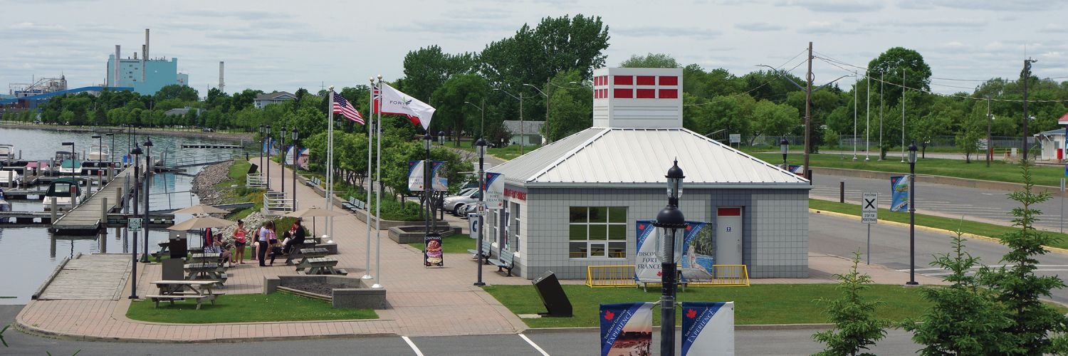
Fort Frances is located across the international bridge from its sister city, International Falls, Minnesota making it the gateway to Northwestern Ontario. Once you cross the bridge into Canada, you are right in Fort Frances. Be sure to stop in at the Fort Frances Ontario Travel Information Centre to pick up a free Ontario Road Map and Travel Guides. Trained Travel Counselors are there to provide information and answer any of your questions. As soon as you go through customs, turn to your left and you'll see the Information Centre. Fort Frances is one of the scenic stops on the "MOM's Way" (Manitoba-Ontario-Minnesota) route.
How do I get to Sunset Country?
Sunset Country is less than a day's drive from many US Midwest cities. All main highways and roads in Sunset Country are paved. From the United States, there are three border crossings - at International Falls, Minnesota, Baudette, Minnesota and at Pigeon River. If you are flying, you can fly into International Falls, MN, Thunder Bay, ON or Winnipeg, MB. Delta Air Lines and SkyWest Air Lines partner to provide air service to Falls International (INL). From there you can rent a car or van or use a shuttle service to get to Fort Frances.
Can I fly into Fort Frances?
Charter and personal flights can land at the Fort Frances Municipal Airport. The Fort Frances Municipal Airport is located on North Boundry Road and has a 4500 runway. For more information call 1-800-334-4460 or 807-274-3930. Visit the CANPASS website for information on Canadian customs and immigration.
What are the speed limits in Ontario?
Speed limits are posted in kilometers. Speed limits on the main highways in the area usually 90 km/hour or 55 mph. Please follow the posted speed limits and watch for wildlife.
- 25 mph = 40 km/hr
- 35 mph = 57 km/hr
- 50 mph = 80 km/hr
- 55 mph = 90 km/hr
- 62 mph = 100 km/hr
Where can I get outfitter maps or fishing maps of the Fort Frances area?
You can order a Free Travel Guide & Map of Sunset Country, which has a large pull-out map that shows all of Northwest Ontario (Accommodations & Lodging are dotted on the area map.) You can purchase maps of the area at www.canadamapsales.com. Hydrographic Charts, Angling Maps and Topographical Maps are available. You can also phone Canada Map Sales 1-877-627-7226 to find out which maps are available for the lakes you will be visiting.
What is the average temperature in Fort Frances?
Here's the average temperature in the Fort Frances area.
What's the current weather in Fort Frances?
Here's the current Fort Frances weather.